
La Safa topographic map
Interactive map
Click on the map to display elevation.
About this map
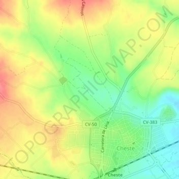
Name: La Safa topographic map, elevation, terrain.
Average elevation: 227 m
Minimum elevation: 192 m
Maximum elevation: 259 m
Other topographic maps
Click on a map to view its topography, its elevation and its terrain.
El Aguilar
Espagne > Communauté Valencienne > Cheste
El Aguilar, Cheste, La Hoya de Buñol, Valence, Communauté Valencienne, 46380, Espagne
Average elevation: 213 m