
Ecclesfield CP topographic map
Interactive map
Click on the map to display elevation.
About this map
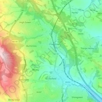
Name: Ecclesfield CP topographic map, elevation, terrain.
Average elevation: 144 m
Minimum elevation: 47 m
Maximum elevation: 315 m
Other topographic maps
Click on a map to view its topography, its elevation and its terrain.
Whitley
United Kingdom > England > Sheffield
Whitley, Sheffield, South Yorkshire Mayoral Combined Authority, England, S35 8RP, United Kingdom
Average elevation: 143 m
Wharncliffe Crags
United Kingdom > England > Sheffield > Stocksbridge
Wharncliffe Crags, Stocksbridge, Sheffield, Yorkshire and the Humber, England, S36 2SQ, United Kingdom
Average elevation: 220 m