
Thank you for supporting this site ❤️
Make a donation
Make a donation
Ostheim topographic map
Click on the map to display elevation.
Thank you for supporting this site ❤️
Make a donation
Make a donation
Ostheim
Ostheim liegt am Südrand der Wetterau und am Fuß des Ronneburger Hügellandes, einem Ausläufer des Vogelsbergs, auf einer Höhe von 135 Metern über NN, etwa 10 km nördlich von Hanau.
Thank you for supporting this site ❤️
Make a donation
Make a donation
About this map
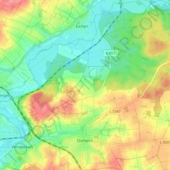
Name: Ostheim topographic map, elevation, terrain.
Location: Ostheim, Nidderau, Main-Kinzig-Kreis, Hessen, Deutschland (50.21543 8.89113 50.26602 8.96278)
Average elevation: 145 m
Minimum elevation: 113 m
Maximum elevation: 187 m
Thank you for supporting this site ❤️
Make a donation
Make a donation