
Make a donation
Mosta topographic map
Click on the map to display elevation.
Make a donation
Mosta
Grognet’s design was based on that of the Pantheon of Rome. Due to debates and doubts regarding the design, the first stone was laid on 30 May 1833. The rotunda has a diameter of 55.20 metres on the outside and 39.60 metres on the inside. The main façade faces south and has six columns in the Ionic style. On each side, a steeple rises from the façade. Following the front elevation, the church has an analogous style at the back, but without steeples. The dome was built on the principle of the catenary profile, meaning that each stone was laid over the one underneath it.
Make a donation
About this map
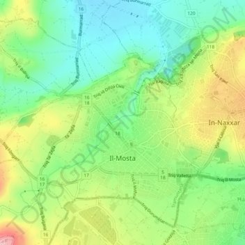
Name: Mosta topographic map, elevation, terrain.
Location: Mosta, Northern Region, Malta (35.89737 14.39301 35.92924 14.43908)
Average elevation: 78 m
Minimum elevation: 8 m
Maximum elevation: 189 m
Make a donation