
North Judson topographic map
Interactive map
Click on the map to display elevation.
About this map
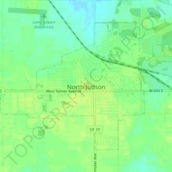
Name: North Judson topographic map, elevation, terrain.
Location: North Judson, Starke County, Indiana, 46366, United States (41.20583 -86.79552 41.22578 -86.76547)
Average elevation: 215 m
Minimum elevation: 206 m
Maximum elevation: 221 m
Other topographic maps
Click on a map to view its topography, its elevation and its terrain.
Koontz Lake
United States > Indiana > Starke County
Koontz Lake, Starke County, Indiana, United States
Average elevation: 221 m
Hamlet
United States > Indiana > Starke County
Hamlet, Starke County, Indiana, United States
Average elevation: 213 m
Bass Lake
United States > Indiana > Starke County
Bass Lake, Starke County, Indiana, 45534, United States
Average elevation: 220 m
Knox
United States > Indiana > Starke County > Knox
Knox, Starke County, Indiana, United States
Average elevation: 216 m
Grovertown
United States > Indiana > Starke County > Grovertown
Grovertown, Starke County, Indiana, 46531, United States
Average elevation: 221 m