
Westbroek topographic map
Interactive map
Click on the map to display elevation.
About this map
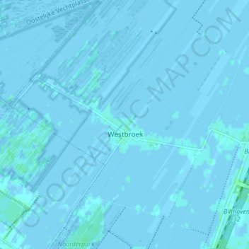
Name: Westbroek topographic map, elevation, terrain.
Location: Westbroek, De Bilt, Utrecht, Niederlande (52.13182 5.09489 52.17252 5.15985)
Average elevation: 0 m
Minimum elevation: -3 m
Maximum elevation: 4 m
Other topographic maps
Click on a map to view its topography, its elevation and its terrain.
Bilthoven
Niederlande > Utrecht > De Bilt
Bilthoven, De Bilt, Utrecht, Niederlande
Average elevation: 5 m
Hollandsche Rading
Niederlande > Utrecht > De Bilt
Hollandsche Rading, De Bilt, Utrecht, Niederlande
Average elevation: 6 m