
Pontianak topographic map
Interactive map
Click on the map to display elevation.
About this map
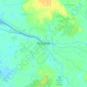
Name: Pontianak topographic map, elevation, terrain.
Location: Pontianak, West Kalimantan, 78243, Indonesia (-0.18269 109.18475 0.13731 109.50475)
Average elevation: 5 m
Minimum elevation: -4 m
Maximum elevation: 21 m
Other topographic maps
Click on a map to view its topography, its elevation and its terrain.
Tengah
Indonesia > West Kalimantan > Pontianak
Tengah, Pontianak Kota, Pontianak, West Kalimantan, Kalimantan, Indonesia
Average elevation: 4 m