
Tilburg topographic map
Interactive map
Click on the map to display elevation.
About this map
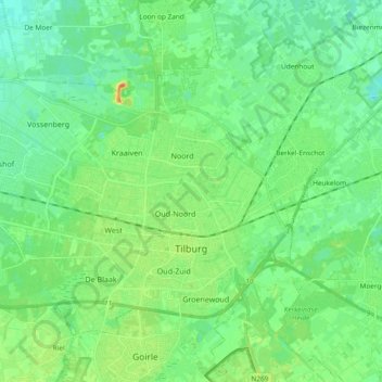
Name: Tilburg topographic map, elevation, terrain.
Location: Tilburg, Nordbrabant, Niederlande (51.52950 4.94785 51.61785 5.13545)
Average elevation: 12 m
Minimum elevation: 2 m
Maximum elevation: 39 m
Other topographic maps
Click on a map to view its topography, its elevation and its terrain.
Oude Leije
Niederlande > Nordbrabant > Tilburg
Oude Leije, Tilburg, Nordbrabant, Niederlande, 5032VJ, Niederlande
Average elevation: 12 m