
Shah Khalkar topographic map
Interactive map
Click on the map to display elevation.
About this map
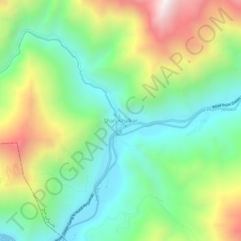
Name: Shah Khalkar topographic map, elevation, terrain.
Location: Shah Khalkar, ولسوالی خنج, Pandjchir, Afghanistan (35.36577 69.62495 35.40577 69.66495)
Average elevation: 2,457 m
Minimum elevation: 2,019 m
Maximum elevation: 3,252 m
Other topographic maps
Click on a map to view its topography, its elevation and its terrain.
Vallée du Pandjchir
Afghanistan > Pandjchir > Bazarak
Vallée du Pandjchir, Bazarak, ولسوالی بازارک, Pandjchir, Afghanistan
Average elevation: 2,101 m