
Thank you for supporting this site ❤️
Make a donation
Make a donation
Sandkrug topographic map
Click on the map to display elevation.
Thank you for supporting this site ❤️
Make a donation
Make a donation
About this map
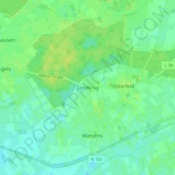
Name: Sandkrug topographic map, elevation, terrain.
Location: Sandkrug, Aurich, Landkreis Aurich, Niedersachsen, Deutschland (53.44282 7.53253 53.48282 7.57253)
Average elevation: 10 m
Minimum elevation: 4 m
Maximum elevation: 16 m
Thank you for supporting this site ❤️
Make a donation
Make a donation
Other topographic maps
Click on a map to view its topography, its elevation and its terrain.
Thank you for supporting this site ❤️
Make a donation
Make a donation
Thank you for supporting this site ❤️
Make a donation
Make a donation
Thank you for supporting this site ❤️
Make a donation
Make a donation
Thank you for supporting this site ❤️
Make a donation
Make a donation