
Noerdange topographic map
Interactive map
Click on the map to display elevation.
About this map
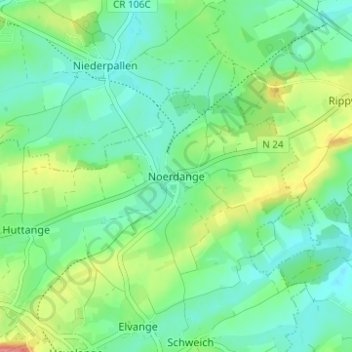
Name: Noerdange topographic map, elevation, terrain.
Location: Noerdange, Beckerich, Canton Redange, 8550, Luxembourg (49.72181 5.90418 49.76181 5.94418)
Average elevation: 284 m
Minimum elevation: 259 m
Maximum elevation: 340 m
Other topographic maps
Click on a map to view its topography, its elevation and its terrain.
Grosbous
Luxembourg > Canton Redange > Grosbous-Wahl
Grosbous, Grosbous-Wahl, Canton Redange, 9154, Luxembourg
Average elevation: 369 m