
Thank you for supporting this site ❤️
Make a donation
Make a donation
Carot topographic map
Click on the map to display elevation.
Thank you for supporting this site ❤️
Make a donation
Make a donation
About this map
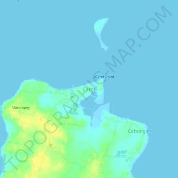
Name: Carot topographic map, elevation, terrain.
Location: Carot, Anda, Pangasinan, Ilocos Region, Philippines (16.32720 119.96623 16.36720 120.00623)
Average elevation: 4 m
Minimum elevation: -1 m
Maximum elevation: 23 m
Thank you for supporting this site ❤️
Make a donation
Make a donation
Other topographic maps
Click on a map to view its topography, its elevation and its terrain.