
Thank you for supporting this site ❤️
Make a donation
Make a donation
Mahmutlar topographic map
Click on the map to display elevation.
Thank you for supporting this site ❤️
Make a donation
Make a donation
About this map
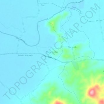
Name: Mahmutlar topographic map, elevation, terrain.
Location: Mahmutlar, Tire, Izmir, Aegean Region, Turkey (38.11174 27.60687 38.15174 27.64687)
Average elevation: 48 m
Minimum elevation: 27 m
Maximum elevation: 207 m
Thank you for supporting this site ❤️
Make a donation
Make a donation