
Likas topographic map
Interactive map
Click on the map to display elevation.
About this map
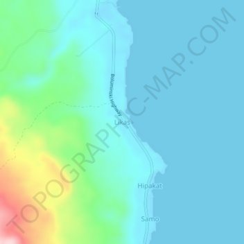
Name: Likas topographic map, elevation, terrain.
Location: Likas, New Ireland, Islands Region, Papua New Guinea (-3.93549 152.80123 -3.89549 152.84123)
Average elevation: 42 m
Minimum elevation: 0 m
Maximum elevation: 241 m
Other topographic maps
Click on a map to view its topography, its elevation and its terrain.
Lavongai
Papua New Guinea > New Ireland
Lavongai, New Ireland, Islands Region, Papua New Guinea
Average elevation: 43 m
New Ireland
Papua New Guinea > New Ireland
New Ireland, Islands Region, Papua New Guinea
Average elevation: 83 m