
Thank you for supporting this site ❤️
Make a donation
Make a donation
Needmore topographic map
Click on the map to display elevation.
Thank you for supporting this site ❤️
Make a donation
Make a donation
About this map
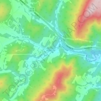
Name: Needmore topographic map, elevation, terrain.
Location: Needmore, Hardy County, West Virginia, United States (39.03066 -78.80669 39.07066 -78.76669)
Average elevation: 547 m
Minimum elevation: 419 m
Maximum elevation: 793 m
Thank you for supporting this site ❤️
Make a donation
Make a donation
Other topographic maps
Click on a map to view its topography, its elevation and its terrain.