
Thank you for supporting this site ❤️
Make a donation
Make a donation
Kessel topographic map
Click on the map to display elevation.
Thank you for supporting this site ❤️
Make a donation
Make a donation
About this map
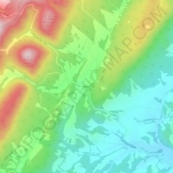
Name: Kessel topographic map, elevation, terrain.
Location: Kessel, Hardy County, West Virginia, 26818, United States (39.05483 -79.05642 39.09483 -79.01642)
Average elevation: 414 m
Minimum elevation: 254 m
Maximum elevation: 694 m
Thank you for supporting this site ❤️
Make a donation
Make a donation
Other topographic maps
Click on a map to view its topography, its elevation and its terrain.