
青秀区 topographic map
Interactive map
Click on the map to display elevation.
About this map
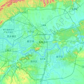
Name: 青秀区 topographic map, elevation, terrain.
Location: 青秀区, 南宁市, 广西壮族自治区, 530028, 中国 (22.65608 108.25045 22.97608 108.57045)
Average elevation: 113 m
Minimum elevation: 57 m
Maximum elevation: 431 m
Other topographic maps
Click on a map to view its topography, its elevation and its terrain.
岑王老山国家级自然保护区
岑王老山国家级自然保护区, 浪平镇, 田林县, 百色市, 广西壮族自治区, 中国
Average elevation: 1,236 m