
Make a donation
Flagstaff Hill topographic map
Click on the map to display elevation.
Make a donation
About this map
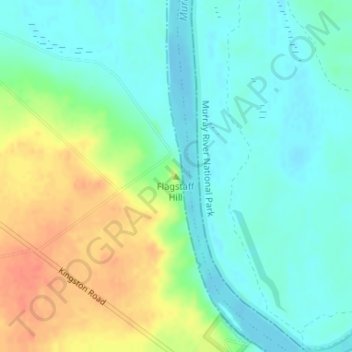
Name: Flagstaff Hill topographic map, elevation, terrain.
Average elevation: 27 m
Minimum elevation: 11 m
Maximum elevation: 56 m
Make a donation
Other topographic maps
Click on a map to view its topography, its elevation and its terrain.
Bookpurnong
Australia > South Australia > The District Council of Loxton Waikerie
Average elevation: 37 m
Kingston on Murray
Australia > South Australia > The District Council of Loxton Waikerie
Average elevation: 32 m
Make a donation
Waikerie
Australia > South Australia > The District Council of Loxton Waikerie
Average elevation: 42 m
Alawoona
Australia > South Australia > The District Council of Loxton Waikerie
Average elevation: 64 m
Make a donation
Make a donation
Woolpunda
Australia > South Australia > The District Council of Loxton Waikerie
Average elevation: 65 m
Waikerie
Australia > South Australia > The District Council of Loxton Waikerie
Average elevation: 42 m