
Thank you for supporting this site ❤️
Make a donation
Make a donation
Cave-in-Rock topographic map
Click on the map to display elevation.
Thank you for supporting this site ❤️
Make a donation
Make a donation
About this map
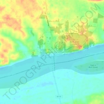
Name: Cave-in-Rock topographic map, elevation, terrain.
Average elevation: 116 m
Minimum elevation: 98 m
Maximum elevation: 146 m
Thank you for supporting this site ❤️
Make a donation
Make a donation
Other topographic maps
Click on a map to view its topography, its elevation and its terrain.
Cave In Rock State Park
United States > Illinois > Hardin County > Cave-In-Rock > Cave-in-Rock
Average elevation: 116 m