
Make a donation
Zlatar topographic map
Click on the map to display elevation.
Make a donation
Zlatar
Zlatar (Serbian Cyrillic: Златар, pronounced [zlǎtaːr]) is a mountain range in southwestern Serbia, lying between towns of Prijepolje and Nova Varoš. Its highest peak is Velika krseva, 1,627 meters tall, peak next to Golo brdo. It belongs to Stari Vlah group of Dinaric Alps. Zlatar is bounded by rivers Uvac, Lim, Mileševka and Bistrica, and has a total of four artificial lakes – Zlatar Lake, Radoinjsko Lake, Uvac Lake and Potpeć. Mountainous climate with significant mediterranean influence, dense pine forests, and a high number of sunny days, is suitable for medicinal purposes and altitude training. At the elevation of 1,237 meters, there is a Special Rehabilitation Hospital "Zlatar" with 330 beds.
Make a donation
About this map
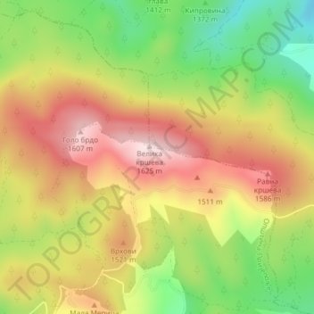
Name: Zlatar topographic map, elevation, terrain.
Average elevation: 1,438 m
Minimum elevation: 1,249 m
Maximum elevation: 1,612 m
Make a donation
Other topographic maps
Click on a map to view its topography, its elevation and its terrain.
Sopotnica
Serbia > Central Serbia > Zlatibor Administrative District > Prijepolje Municipality
Average elevation: 1,053 m
Prijepolje
Serbia > Central Serbia > Zlatibor Administrative District > Prijepolje Municipality
The municipality of Prijepolje covers an area of 824 km2 (318 sq mi) with an altitude ranging from 440–1,735 metres (1,444–5,692 ft). Not including the town of Prijepolje itself, it contains 96 other settlements. Those settlements are as follows, with population figures according to the 2002 census.
Average elevation: 676 m
Kosatica
Serbia > Central Serbia > Zlatibor Administrative District > Prijepolje Municipality
Average elevation: 1,057 m
Miljevici
Serbia > Central Serbia > Zlatibor Administrative District > Prijepolje Municipality
Average elevation: 724 m
Make a donation