
Derrymattry topographic map
Interactive map
Click on the map to display elevation.
About this map
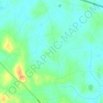
Name: Derrymattry topographic map, elevation, terrain.
Average elevation: 21 m
Minimum elevation: 10 m
Maximum elevation: 48 m
Other topographic maps
Click on a map to view its topography, its elevation and its terrain.
Drumnevan
Royaume-Uni > Irlande du Nord > Scotch Street
Drumnevan, Scotch Street, County Armagh, Irlande du Nord, Royaume-Uni
Average elevation: 28 m
Ballyfodrin
Royaume-Uni > Irlande du Nord > Scotch Street
Ballyfodrin, Scotch Street, County Armagh, Irlande du Nord, Royaume-Uni
Average elevation: 28 m