
Moers topographic map
Interactive map
Click on the map to display elevation.
About this map
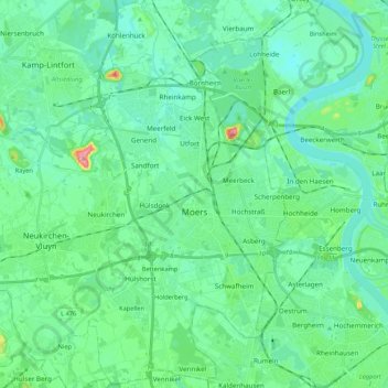
Name: Moers topographic map, elevation, terrain.
Location: Moers, Kreis Wesel, Rhénanie-du-Nord-Westphalie, Allemagne (51.39080 6.55837 51.52378 6.67874)
Average elevation: 28 m
Minimum elevation: 11 m
Maximum elevation: 98 m
Other topographic maps
Click on a map to view its topography, its elevation and its terrain.
Labbeck
Allemagne > Rhénanie-du-Nord-Westphalie > Kreis Wesel
Labbeck, Sonsbeck, Kreis Wesel, Rhénanie-du-Nord-Westphalie, 47665, Allemagne
Average elevation: 43 m
Wesel
Allemagne > Rhénanie-du-Nord-Westphalie > Kreis Wesel
Wesel, Kreis Wesel, Rhénanie-du-Nord-Westphalie, Allemagne
Average elevation: 26 m