
Thank you for supporting this site ❤️
Make a donation
Make a donation
Pointe La Rue topographic map
Click on the map to display elevation.
Thank you for supporting this site ❤️
Make a donation
Make a donation
About this map
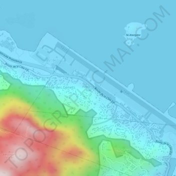
Name: Pointe La Rue topographic map, elevation, terrain.
Location: Pointe La Rue, Seychelles (-4.68017 55.50630 -4.66724 55.53455)
Average elevation: 99 m
Minimum elevation: -8 m
Maximum elevation: 542 m
Thank you for supporting this site ❤️
Make a donation
Make a donation