Geolocate

Samtskhe-Javakheti topographic map

Interactive map

Click on the map to display elevation.

About this map

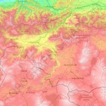
Name: Samtskhe-Javakheti topographic map, elevation, terrain.

Location: Samtskhe-Javakheti, Georgia (41.10933 42.49199 41.94390 43.96659)

Average elevation: 1,818 m

Minimum elevation: 122 m

Maximum elevation: 3,277 m

Other topographic maps

Click on a map to view its topography, its elevation and its terrain.

Shovi

Georgia > Racha-Lechkhumi and Lower Svaneti > Oni Municipality

Shovi, Oni Municipality, Racha-Lechkhumi and Lower Svaneti, Georgia

Average elevation: 1,792 m

Samegrelo-Upper Svaneti

Georgia

Samegrelo-Upper Svaneti, Georgia

Average elevation: 1,104 m

Autonomous Republic of Adjara

Georgia

Autonomous Republic of Adjara, Georgia

Average elevation: 802 m

Tbilisi

Georgia

Tbilisi, Georgia

Average elevation: 752 m

Zhabeshi

Georgia > Samegrelo-Upper Svaneti > Zhabeshi

Zhabeshi, Mestia Municipality, Samegrelo-Upper Svaneti, Georgia

Average elevation: 1,990 m

Tsaneri Glacier

Georgia > Samegrelo-Upper Svaneti

Tsaneri Glacier, Mestia Municipality, Samegrelo-Upper Svaneti, Georgia

Average elevation: 3,592 m

Ushba

Georgia > Samegrelo-Upper Svaneti

Ushba, Mestia Municipality, Samegrelo-Upper Svaneti, Georgia

Average elevation: 3,640 m

Stepantsminda

Georgia > Mtskheta-Mtianeti > Stepantsminda

Stepantsminda, Kazbegi Municipality, Mtskheta-Mtianeti, Georgia

Average elevation: 1,855 m

Caucasus Mountains

Georgia > Mtskheta-Mtianeti

Caucasus Mountains, Dusheti Municipality, Mtskheta-Mtianeti, Georgia

Average elevation: 2,188 m

Mount Mkinvartsveri (Kazbegi)

Georgia > Mtskheta-Mtianeti

Mount Mkinvartsveri (Kazbegi), Kazbegi Municipality, Mtskheta-Mtianeti, Georgia

Average elevation: 4,324 m