
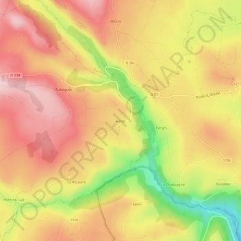
Aubac topographic map
Interactive map
Click on the map to display elevation.
About this map
Name: Aubac topographic map, elevation, terrain.
Average elevation: 1,046 m
Minimum elevation: 891 m
Maximum elevation: 1,144 m
Other topographic maps
Click on a map to view its topography, its elevation and its terrain.
Les Chabasses
France > Auvergne-Rhône-Alpes > Cantal > Cézens
Les Chabasses, Cézens, Saint-Flour, Cantal, Auvergne-Rhône-Alpes, France métropolitaine, 15230, France
Average elevation: 1,215 m
Perpezat
France > Auvergne-Rhône-Alpes > Cantal > Cézens
Perpezat, Cézens, Saint-Flour, Cantal, Auvergne-Rhône-Alpes, France métropolitaine, 15230, France
Average elevation: 1,107 m