
Curgos topographic map
Interactive map
Click on the map to display elevation.
About this map
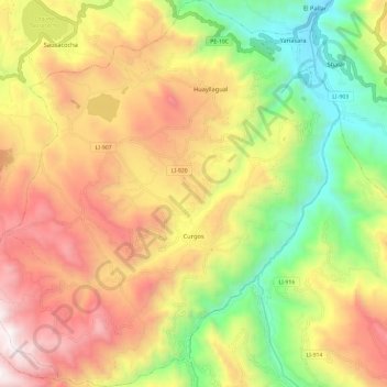
Name: Curgos topographic map, elevation, terrain.
Location: Curgos, Provincia de Sánchez Carrión, La Libertad, Perú (-7.90580 -78.00783 -7.78897 -77.89893)
Average elevation: 3,168 m
Minimum elevation: 2,344 m
Maximum elevation: 4,038 m