
Thank you for supporting this site ❤️
Make a donation
Make a donation
Majakeng topographic map
Click on the map to display elevation.
Thank you for supporting this site ❤️
Make a donation
Make a donation
About this map
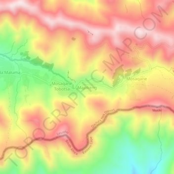
Name: Majakeng topographic map, elevation, terrain.
Location: Majakeng, Qacha's Nek District, Lesotho (-30.12122 28.72167 -30.08122 28.76167)
Average elevation: 2,188 m
Minimum elevation: 1,873 m
Maximum elevation: 2,424 m
Thank you for supporting this site ❤️
Make a donation
Make a donation