
Thank you for supporting this site ❤️
Make a donation
Make a donation
Goldfield topographic map
Click on the map to display elevation.
Thank you for supporting this site ❤️
Make a donation
Make a donation
About this map
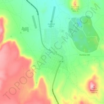
Name: Goldfield topographic map, elevation, terrain.
Location: Goldfield, Esmeralda County, Nevada, 89013, United States (37.68777 -117.25407 37.72777 -117.21407)
Average elevation: 1,776 m
Minimum elevation: 1,671 m
Maximum elevation: 1,918 m
Thank you for supporting this site ❤️
Make a donation
Make a donation
Other topographic maps
Click on a map to view its topography, its elevation and its terrain.