
Rother topographic map
Interactive map
Click on the map to display elevation.
About this map
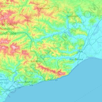
Name: Rother topographic map, elevation, terrain.
Location: Rother, East Sussex, South East, Engeland, VK (50.81931 0.32156 51.08365 0.86786)
Average elevation: 36 m
Minimum elevation: -2 m
Maximum elevation: 193 m
Other topographic maps
Click on a map to view its topography, its elevation and its terrain.
Tillingham
Tillingham, Rother, East Sussex, South East, Engeland, TN31 6ET, VK
Average elevation: 39 m