
Thank you for supporting this site ❤️
Make a donation
Make a donation
Talilt topographic map
Click on the map to display elevation.
Thank you for supporting this site ❤️
Make a donation
Make a donation
About this map
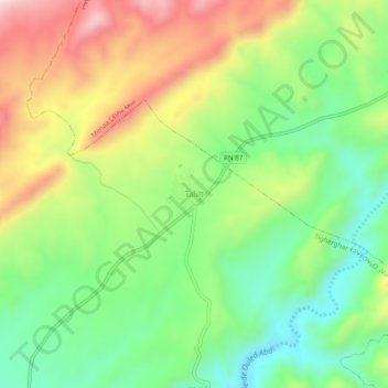
Name: Talilt topographic map, elevation, terrain.
Location: Talilt, Tigherghar, Menaa district, Batna, Algeria (35.14023 5.95044 35.18023 5.99044)
Average elevation: 975 m
Minimum elevation: 782 m
Maximum elevation: 1,249 m
Thank you for supporting this site ❤️
Make a donation
Make a donation