
Thank you for supporting this site ❤️
Make a donation
Make a donation
Tiagba topographic map
Click on the map to display elevation.
Thank you for supporting this site ❤️
Make a donation
Make a donation
About this map
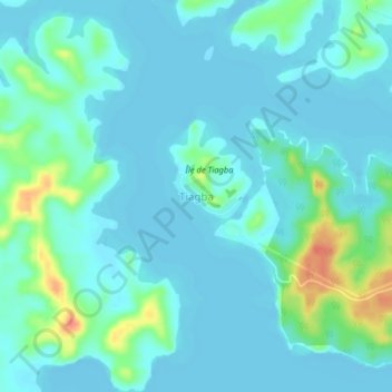
Name: Tiagba topographic map, elevation, terrain.
Location: Tiagba, Grands-Ponts, Lagunes, Côte d'Ivoire (5.24064 -4.74310 5.28064 -4.70310)
Average elevation: 10 m
Minimum elevation: -6 m
Maximum elevation: 55 m
Thank you for supporting this site ❤️
Make a donation
Make a donation