
دانگام ولسوالۍ topographic map
Interactive map
Click on the map to display elevation.
About this map
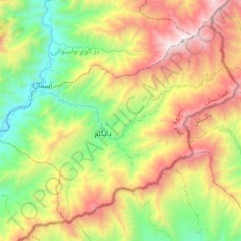
Name: دانگام ولسوالۍ topographic map, elevation, terrain.
Location: دانگام ولسوالۍ, Kounar, Afghanistan (34.91650 71.31014 35.08840 71.55860)
Average elevation: 1,972 m
Minimum elevation: 872 m
Maximum elevation: 3,683 m