
Gemeinde Schwendau topographic map
Interactive map
Click on the map to display elevation.
About this map
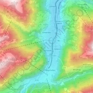
Name: Gemeinde Schwendau topographic map, elevation, terrain.
Location: Gemeinde Schwendau, Bezirk Schwaz, Tirol, Oostenrijk (47.16735 11.76401 47.20414 11.87103)
Average elevation: 1,459 m
Minimum elevation: 579 m
Maximum elevation: 2,621 m