
Verviers topographic map
Interactive map
Click on the map to display elevation.
About this map
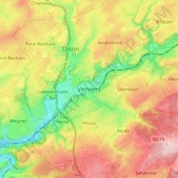
Name: Verviers topographic map, elevation, terrain.
Location: Verviers, Liège, Wallonie, 4800, Belgique (50.55324 5.82783 50.63324 5.90783)
Average elevation: 261 m
Minimum elevation: 136 m
Maximum elevation: 396 m
Other topographic maps
Click on a map to view its topography, its elevation and its terrain.