
East Texas topographic map
Interactive map
Click on the map to display elevation.
About this map
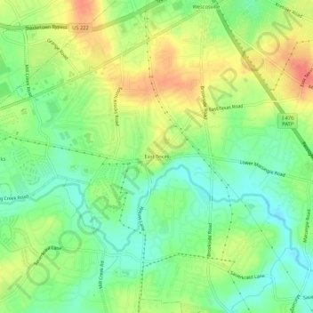
Name: East Texas topographic map, elevation, terrain.
Average elevation: 126 m
Minimum elevation: 101 m
Maximum elevation: 157 m
Other topographic maps
Click on a map to view its topography, its elevation and its terrain.
Hensingersville
United States > Pennsylvania > Lehigh County > Lower Macungie Township
Hensingersville, Lower Macungie Township, Lehigh County, Pennsylvania, 18011, United States
Average elevation: 203 m
Wescosville
United States > Pennsylvania > Lehigh County > Lower Macungie Township
Wescosville, Lower Macungie Township, Lehigh County, Pennsylvania, 18106, United States
Average elevation: 128 m