
Thank you for supporting this site ❤️
Make a donation
Make a donation
Pangkor Island topographic map
Click on the map to display elevation.
Thank you for supporting this site ❤️
Make a donation
Make a donation
About this map
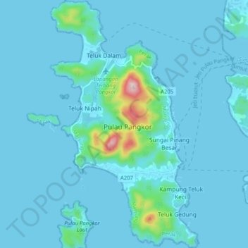
Name: Pangkor Island topographic map, elevation, terrain.
Location: Pangkor Island, Gedung Bay, Manjung, Perak, 32300, Malaysia (4.18819 100.53573 4.26642 100.58269)
Average elevation: 26 m
Minimum elevation: -2 m
Maximum elevation: 357 m
Thank you for supporting this site ❤️
Make a donation
Make a donation