
Thank you for supporting this site ❤️
Make a donation
Make a donation
Gorkin Bala topographic map
Click on the map to display elevation.
Thank you for supporting this site ❤️
Make a donation
Make a donation
About this map
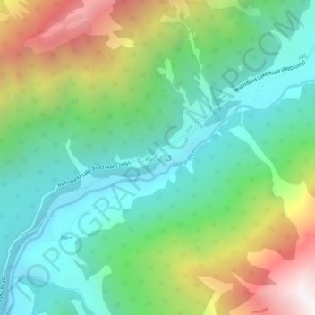
Name: Gorkin Bala topographic map, elevation, terrain.
Average elevation: 2,612 m
Minimum elevation: 1,986 m
Maximum elevation: 3,903 m
Thank you for supporting this site ❤️
Make a donation
Make a donation
Other topographic maps
Click on a map to view its topography, its elevation and its terrain.
Mahundand Lake
Pakistan > Khyber Pakhtunkhwa > Swat District > Kalam Tehsil
Average elevation: 3,215 m