
Shari topographic map
Interactive map
Click on the map to display elevation.
About this map
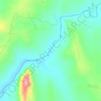
Name: Shari topographic map, elevation, terrain.
Average elevation: 1,005 m
Minimum elevation: 957 m
Maximum elevation: 1,116 m
Other topographic maps
Click on a map to view its topography, its elevation and its terrain.
Bunia
Democratic Republic of the Congo > Ituri > Bunia
Bunia, Irumu, Orientale, Ituri, Democratic Republic of the Congo
Average elevation: 1,271 m