
Plav topographic map
Interactive map
Click on the map to display elevation.
About this map
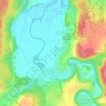
Name: Plav topographic map, elevation, terrain.
Location: Plav, okres České Budějovice, Southwest, Czechia (48.89397 14.45131 48.91955 14.49697)
Average elevation: 429 m
Minimum elevation: 394 m
Maximum elevation: 492 m
Other topographic maps
Click on a map to view its topography, its elevation and its terrain.