
Thank you for supporting this site ❤️
Make a donation
Make a donation
Willard topographic map
Click on the map to display elevation.
Thank you for supporting this site ❤️
Make a donation
Make a donation
About this map
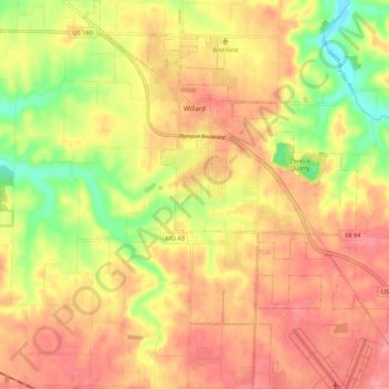
Name: Willard topographic map, elevation, terrain.
Location: Willard, Greene County, Missouri, United States (37.24221 -93.45987 37.32912 -93.38278)
Average elevation: 363 m
Minimum elevation: 312 m
Maximum elevation: 396 m
Thank you for supporting this site ❤️
Make a donation
Make a donation
Other topographic maps
Click on a map to view its topography, its elevation and its terrain.