
Lotissement Le Pralot topographic map
Interactive map
Click on the map to display elevation.
About this map
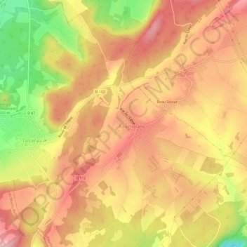
Name: Lotissement Le Pralot topographic map, elevation, terrain.
Average elevation: 526 m
Minimum elevation: 405 m
Maximum elevation: 597 m
Other topographic maps
Click on a map to view its topography, its elevation and its terrain.
Tarcenay
France > Bourgogne-Franche-Comté > Doubs > Tarcenay-Foucherans
Tarcenay, Tarcenay-Foucherans, Besançon, Doubs, Bourgogne-Franche-Comté, France métropolitaine, 25620, France
Average elevation: 485 m