
茅坪镇 topographic map
Interactive map
Click on the map to display elevation.
About this map
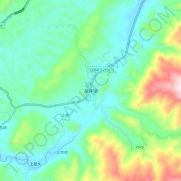
Name: 茅坪镇 topographic map, elevation, terrain.
Location: 茅坪镇, 城步苗族自治县, 邵阳市, 湖南省, 中国 (26.47282 110.37214 26.55282 110.45214)
Average elevation: 619 m
Minimum elevation: 422 m
Maximum elevation: 1,183 m
帽子头是最高点,海拔1191米。
Other topographic maps
Click on a map to view its topography, its elevation and its terrain.