
Itere topographic map
Interactive map
Click on the map to display elevation.
About this map
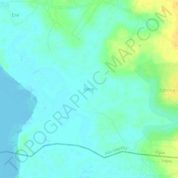
Name: Itere topographic map, elevation, terrain.
Location: Itere, Ado Odo/Ota, Ogun State, Nigeria (6.49667 2.89667 6.53667 2.93667)
Average elevation: 7 m
Minimum elevation: -5 m
Maximum elevation: 25 m
Other topographic maps
Click on a map to view its topography, its elevation and its terrain.