
Sardal topographic map
Interactive map
Click on the map to display elevation.
About this map
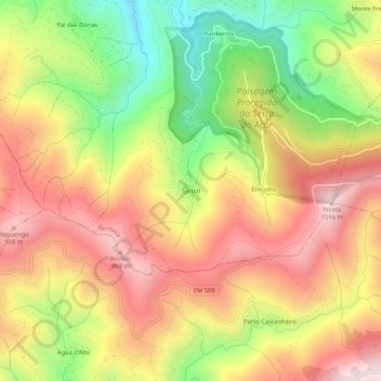
Name: Sardal topographic map, elevation, terrain.
Location: Sardal, Benfeita, Arganil, Coimbra, 3305-031, Portugal (40.18854 -7.95624 40.22854 -7.91624)
Average elevation: 689 m
Minimum elevation: 305 m
Maximum elevation: 1,019 m
Other topographic maps
Click on a map to view its topography, its elevation and its terrain.