
Santa Rosa del Sur topographic map
Interactive map
Click on the map to display elevation.
About this map
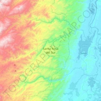
Name: Santa Rosa del Sur topographic map, elevation, terrain.
Location: Santa Rosa del Sur, Bolívar, Colombia (7.92352 -74.09064 8.00352 -74.01064)
Average elevation: 513 m
Minimum elevation: 152 m
Maximum elevation: 818 m
Other topographic maps
Click on a map to view its topography, its elevation and its terrain.
Quinta Paredes
Colombia > Bolívar > Santa Rosa del Sur
Quinta Paredes, Santa Rosa del Sur, Bolívar, Colombia
Average elevation: 594 m