
Skiatook topographic map
Interactive map
Click on the map to display elevation.
About this map
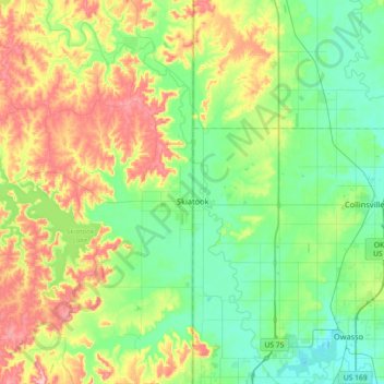
Name: Skiatook topographic map, elevation, terrain.
Location: Skiatook, Osage County, Oklahoma, 74070, United States (36.30105 -96.28195 36.44866 -95.92084)
Average elevation: 222 m
Minimum elevation: 174 m
Maximum elevation: 317 m
Other topographic maps
Click on a map to view its topography, its elevation and its terrain.
Foraker
United States > Oklahoma > Osage County
Foraker, Osage County, Oklahoma, United States
Average elevation: 385 m
Fairfax
United States > Oklahoma > Osage County
Fairfax, Osage County, Oklahoma, United States
Average elevation: 259 m
Herd
United States > Oklahoma > Osage County
Herd, Osage County, Oklahoma, United States
Average elevation: 287 m
Osage County
United States > Oklahoma > Osage County
Osage County, Oklahoma, United States
Average elevation: 277 m