
Thank you for supporting this site ❤️
Make a donation
Make a donation
Penedones topographic map
Click on the map to display elevation.
Thank you for supporting this site ❤️
Make a donation
Make a donation
About this map
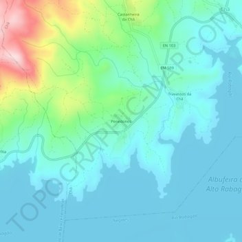
Name: Penedones topographic map, elevation, terrain.
Location: Penedones, Chã, Montalegre, Vila Real, 5470-071, Portugal (41.74286 -7.82909 41.78286 -7.78909)
Average elevation: 913 m
Minimum elevation: 856 m
Maximum elevation: 1,150 m
Thank you for supporting this site ❤️
Make a donation
Make a donation