
Thank you for supporting this site ❤️
Make a donation
Make a donation
Galleywood topographic map
Click on the map to display elevation.
Thank you for supporting this site ❤️
Make a donation
Make a donation
About this map
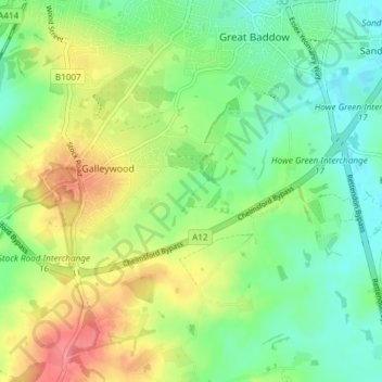
Name: Galleywood topographic map, elevation, terrain.
Location: Galleywood, Chelmsford, Essex, England, United Kingdom (51.68348 0.45149 51.71038 0.52612)
Average elevation: 53 m
Minimum elevation: 24 m
Maximum elevation: 98 m
Thank you for supporting this site ❤️
Make a donation
Make a donation
Other topographic maps
Click on a map to view its topography, its elevation and its terrain.