
Thank you for supporting this site ❤️
Make a donation
Make a donation
Blue topographic map
Click on the map to display elevation.
Thank you for supporting this site ❤️
Make a donation
Make a donation
About this map
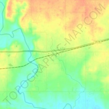
Name: Blue topographic map, elevation, terrain.
Location: Blue, Bryan County, Oklahoma, 74726, United States (33.97649 -96.24999 34.01649 -96.20999)
Average elevation: 177 m
Minimum elevation: 155 m
Maximum elevation: 196 m
Thank you for supporting this site ❤️
Make a donation
Make a donation
Other topographic maps
Click on a map to view its topography, its elevation and its terrain.