
Thank you for supporting this site ❤️
Make a donation
Make a donation
Wedringen topographic map
Click on the map to display elevation.
Thank you for supporting this site ❤️
Make a donation
Make a donation
About this map
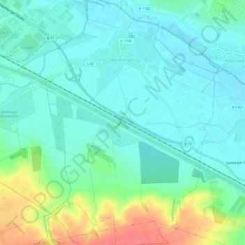
Name: Wedringen topographic map, elevation, terrain.
Location: Wedringen, Haldensleben, Börde, Sachsen-Anhalt, Deutschland (52.24507 11.44635 52.28157 11.48881)
Average elevation: 63 m
Minimum elevation: 47 m
Maximum elevation: 107 m
Thank you for supporting this site ❤️
Make a donation
Make a donation
Other topographic maps
Click on a map to view its topography, its elevation and its terrain.